June 13, 2026
Atlanta to Orlando: Hills to Florida Flatlands
See what you may fly over from Hartsfield Jackson Atlanta to Orlando, including Georgia, Appalachian Mountains, Atlantic coastal plain and Florida.
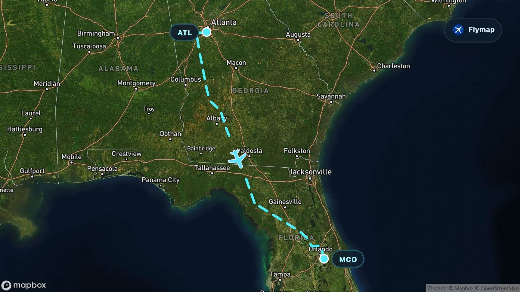
Distance
737 km
Timing
1h 05m
Countries
1 country
This flight changes character as it moves south. It starts above Atlanta’s inland, tree-covered urban region, passes quickly beyond the faint Appalachian edge, then settles into the broad Atlantic Coastal Plain before reaching the flatter, lake-dotted landscape of Central Florida.
That shift is the route’s main story: from Georgia’s rolling ground to Florida’s low peninsula. Flymap helps turn the view from a patchwork of fields, forests, rivers, and suburbs into a clearer sequence beneath the aircraft.
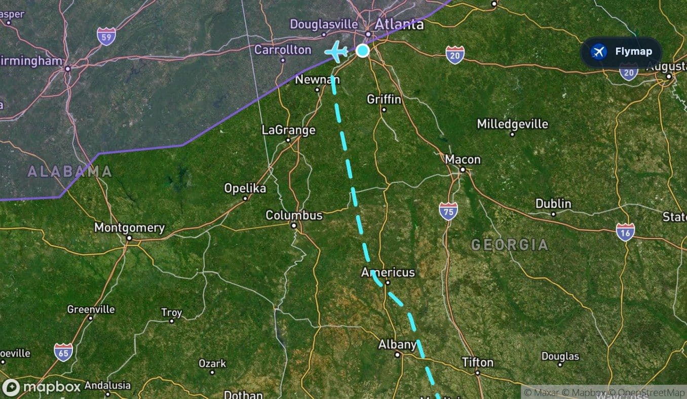
Atlanta rises out of a green inland city
Departing from Hartsfield Jackson Atlanta International Airport, the first view is shaped by one of the largest aviation landscapes in the United States: runways, terminals, highways, and Atlanta’s surrounding urban spread.
Atlanta is not a coastal city, and that matters from the window. The ground around it is greener and more rolling than the flatter terrain closer to Orlando. The wider departure landscape includes Atlanta, College Park, East Point, Decatur, and the Flint River, with suburbs and roads mixed into a dense canopy of trees.
Depending on the departure path, passengers may see the city grid, airport infrastructure, or nearby patches of forest and water. The view quickly becomes less metropolitan as the aircraft turns south over Georgia.
A brief Appalachian edge, then the land opens
The route includes only a short encounter with the Appalachian Mountains, so this is not a full mountain crossing like some flights farther north. Still, the presence of that ancient mountain system helps explain why the early part of the route can feel gently uneven rather than completely flat.
Soon after departure, the landscape starts to soften into lower, broader terrain. The ridges and uplands lose importance, and the route begins moving toward the Atlantic Coastal Plain. From a window seat, that transition may appear as a gradual change rather than a single dramatic line.
Look for the scenery becoming:
- less ridge-led and more open
- more agricultural and river-shaped
- flatter as the aircraft moves deeper into the Southeast
- less dominated by Atlanta’s dense road and suburb pattern
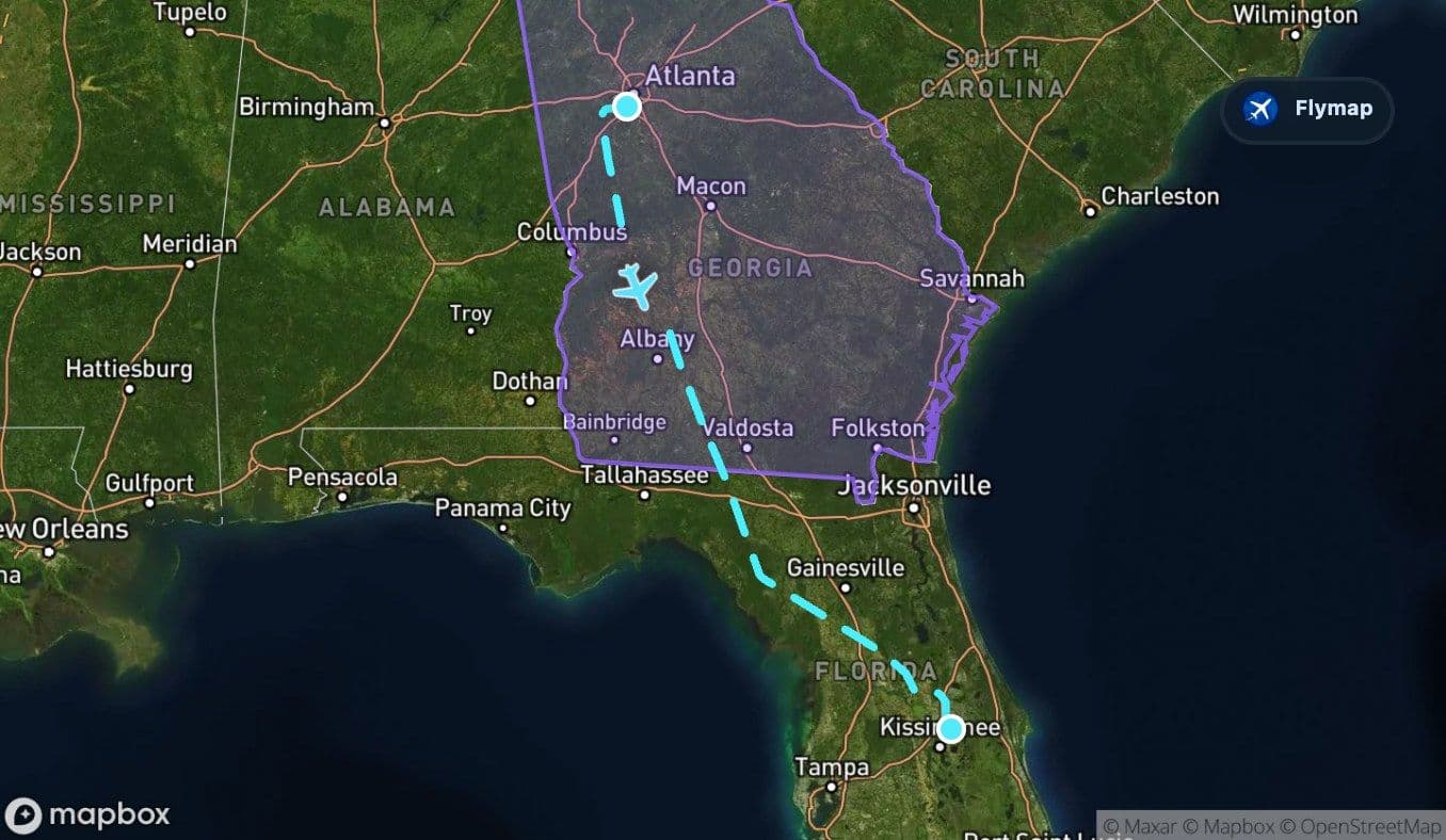
The coastal plain takes over
The Atlantic Coastal Plain is the main geographic feature of this route. It stretches along the eastern United States and slopes gently toward the Atlantic, with rivers, wetlands, and broad lowlands shaping the view.
On this flight, the coastal plain is not just a short background region. It dominates the long middle and final stretch, linking southern Georgia with northern and central Florida. From above, it may look flatter and more spread out than the Atlanta side of the journey.
This part of the route is about subtle patterns: rivers curving through low ground, towns separated by fields and forests, and a less dramatic but very readable change in terrain. It is a landscape of gentle slopes, wide drainage, and low horizons rather than mountains or canyons.
The route’s biggest visual contrast is not city to city. It is rolling inland Georgia becoming the flat, watery Southeast.
South Georgia: rivers, farms, and wider spacing
As the aircraft continues across Georgia, the urban density around Atlanta gives way to more open settlement patterns. The route’s wider landscape includes places such as Macon, Warner Robins, Albany, Tifton, Valdosta, and the Flint River.
Not every place will be visible from every seat, but they describe the type of geography below: a state crossed by rivers, towns, agricultural areas, and wooded land. Compared with the start of the flight, the ground looks less like a metropolitan region and more like a broad southern plain.
This is a useful stretch for watching scale. Roads become longer, towns more separated, and rivers more important as organizing lines in the landscape.
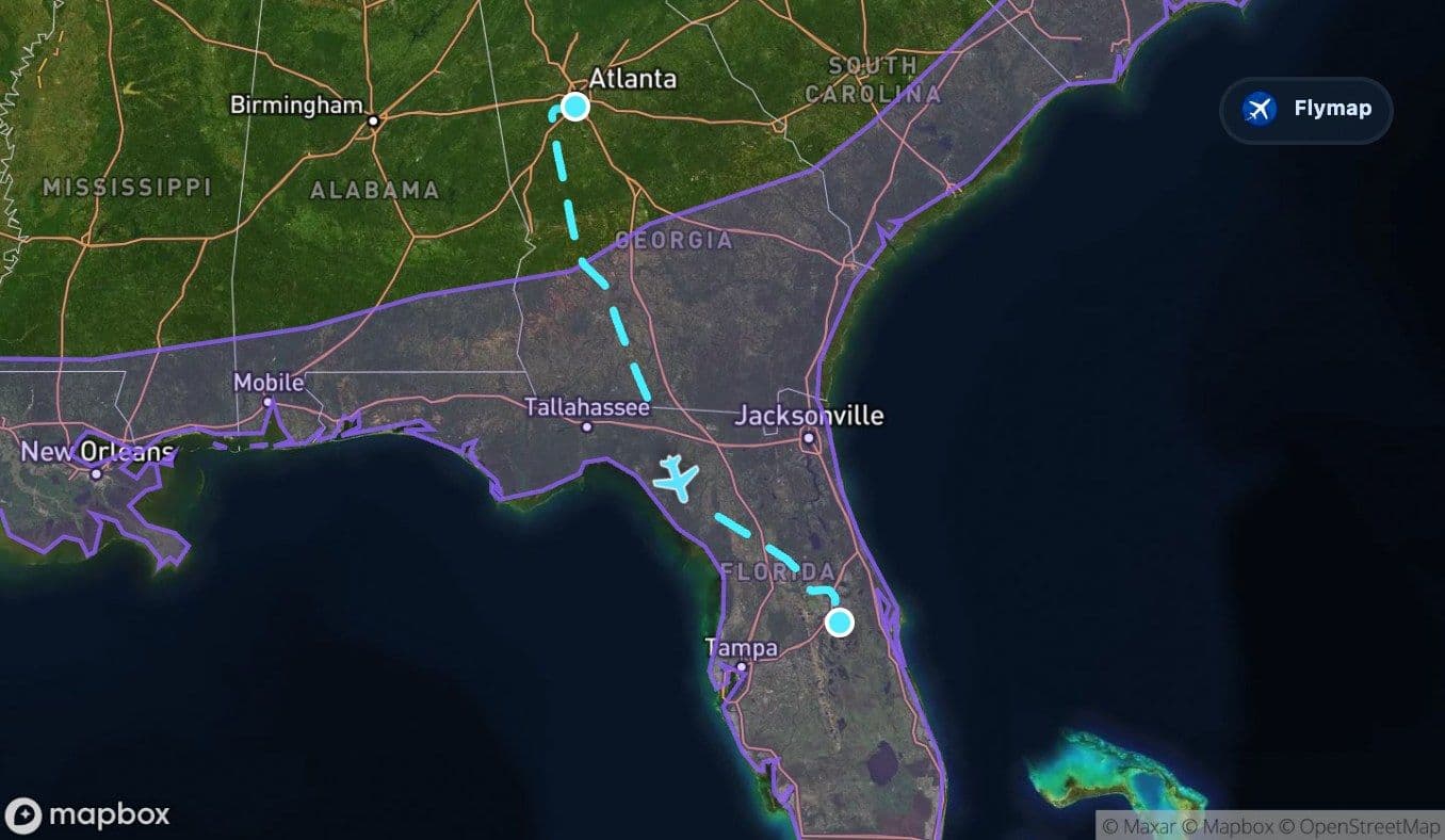
Crossing into the Florida peninsula
Once the flight reaches Florida, the view shifts again. The route enters a state defined by coastal plains, wetlands, inland lakes, and a long peninsula extending into warm waters.

The Florida section includes the broader peninsula landscape before the approach into Orlando. Places associated with the route include Gainesville, Ocala, Leesburg, Winter Garden, Winter Park, Kissimmee, and Orlando itself. The Suwannee River is also part of the wider regional geography, marking the kind of river-and-wetland landscape that becomes more important in northern Florida.
From the window, Florida can look unusually flat. Instead of ridges or strong elevation changes, passengers may notice lakes, ponds, wetlands, roads, subdivisions, and patches of forest spread across low terrain.
Orlando’s lake-dotted arrival
The arrival into Orlando is often defined by water and suburbia. Central Florida is full of lakes, and the approach can show a mosaic of rounded water bodies, planned communities, roads, airports, and open green spaces.
Orlando is known for tourism and theme park complexes, but from the air the first geographic impression may be simpler: flat land, many lakes, and a large urban region built into the interior of the peninsula. Orlando International Airport sits southeast of the city center, so the final approach can feel less coastal than many Florida arrivals.
After the rolling Georgia start and the long coastal plain crossing, the flight ends in a landscape that is unmistakably Floridian: low, watery, and spread out.
Route summary
- The route runs from Hartsfield Jackson Atlanta International Airport to Orlando International Airport entirely within the United States.
- It begins over Georgia, with Atlanta’s urban region, rolling terrain, rivers, and wooded areas.
- A short Appalachian edge appears early, but the main transition is toward lower, flatter land.
- The Atlantic Coastal Plain dominates much of the route from Georgia into Florida.
- The final approach crosses the Florida peninsula, where lakes, wetlands, suburbs, and flat terrain shape the view.
*Data based on a historical route track for DL1742.
Route Gallery (5 images)
Download this or any other flight map in Flymap app
Open Flymap on your phone for app-store download links and offline-ready flight maps.
Flymap app