June 13, 2026
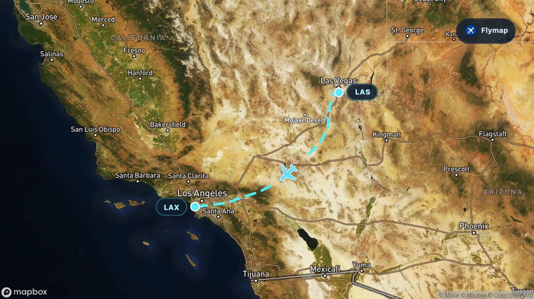
Las Vegas to Los Angeles Over Desert Basins
See what you may fly over from Harry Reid to Los Angeles, including Nevada, Great Basin and California.
Distance
428 km
Timing
40 min
Countries
1 country
The terrain unfolds fast on the Las Vegas to Los Angeles flight. One minute the aircraft is climbing out of a desert city surrounded by dry valleys and ridges; soon after, it is crossing the wide basin-and-range country of the interior West before dropping toward California’s mountains, suburbs, and coastal-edge city grid.
For a short flight, this route has a strong visual sequence. Flymap helps make that sequence readable from the window: Nevada desert, Great Basin openness, California high desert, mountain barriers, and finally the Los Angeles basin.
Neon city, dry valley, sharp ridges
Las Vegas sits in an arid landscape where the city grid stands out against desert ground. From the window, the departure can feel unusually clear because the surrounding terrain is open: pale basins, darker ridges, straight roads, and built-up areas clustered around the valley.
The route begins in Nevada, where arid basins and mountain ranges alternate across the region. This is not a landscape of continuous green. It is a pattern of dry flats and raised edges, with the city acting like a bright, geometric patch inside a much larger desert setting.
Nearby places in the wider departure landscape include Las Vegas, Henderson, North Las Vegas, Nellis Air Force Base, and the broader desert around the airport. Exact visibility depends on the departure path and window side, but the contrast between city and basin is usually the key idea.
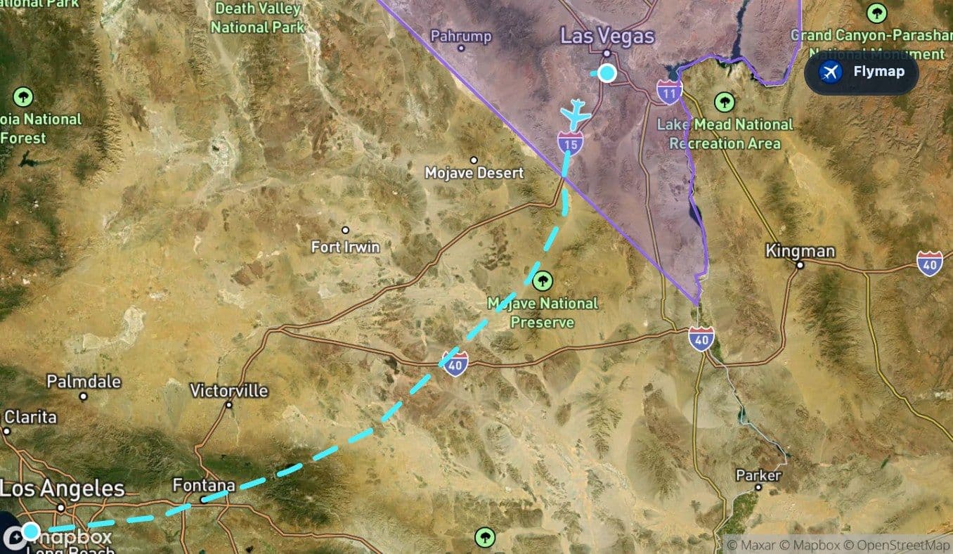
The Great Basin takes over
The Great Basin is the main geographic anchor of the early flight. It is an immense interior basin region, and the route spends a meaningful part of the journey above it before fully entering California.
From above, the Great Basin can look almost diagrammatic: isolated valleys, parallel mountain ranges, dry washes, and long empty spaces. The route data describes a region where rivers rarely reach the ocean, which helps explain the look of the land. Water does not gather into lush, connected river corridors in the same way it does in wetter regions.
This is the best stretch for watching shape rather than landmarks. The ground may show:
- pale desert flats between darker uplands
- long ridge lines running across the view
- sparse settlement compared with the Los Angeles end of the flight
- roads and tracks cutting through large open areas
The route’s strongest visual change is from basin-and-range desert to the dense urban fabric of Southern California.
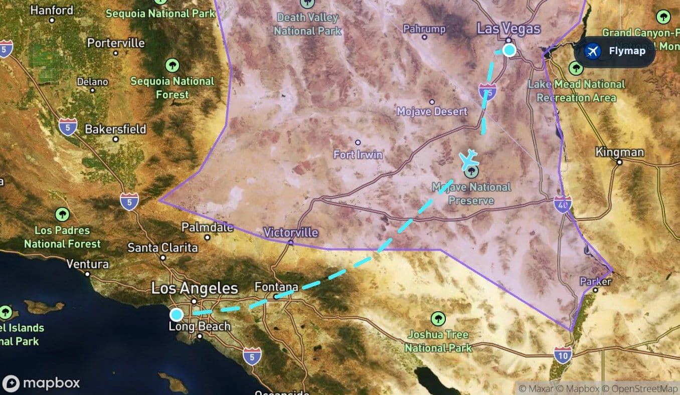
Crossing into California’s desert side
Soon after departure, the flight enters California, but not the beach-and-palm version many travelers picture first. This is California’s inland desert and mountain side, a landscape of dry basins, high ground, and long approaches toward the Los Angeles region.
The wider corridor includes places such as Victorville, Barstow, Apple Valley, and the Mojave River. The Mojave River is intermittent, so its landscape role is different from a large permanent river in a greener region. From above, desert channels and valley floors may be easier to notice as shapes than as obvious blue water.
This section is a reminder that Los Angeles is not simply beside the Pacific. It is backed by deserts and mountains, and flights from Las Vegas cross that interior geography first.
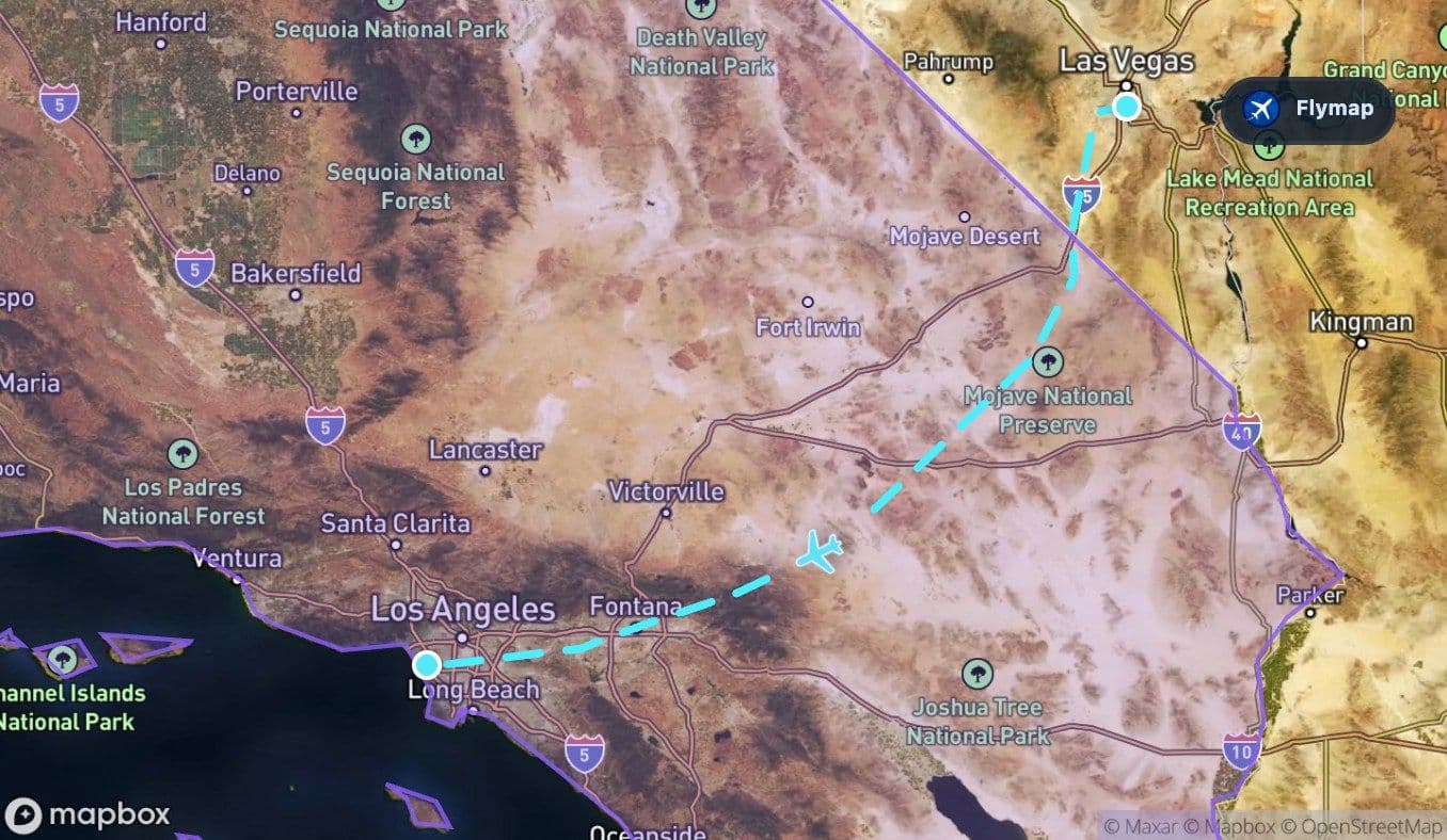
Mountains before the basin
As the aircraft continues southwest, Southern California’s mountains become part of the view. The wider region associated with this route includes San Gorgonio Mountain, San Jacinto Peak, Mount San Antonio, Big Bear Lake, and the Santa Monica Mountains.
These features may not all be visible on every flight, but they explain the terrain pattern approaching Los Angeles: the city basin is protected and framed by high ground. On a clear day, mountain ridges can appear as darker barriers between the open desert and the urban plain.
This is where the landscape begins to compress. The emptier desert spaces give way to more roads, towns, reservoirs, and suburban patterns, while the mountain lines still shape the route into the basin.
The Los Angeles basin appears
The arrival side changes the view dramatically. Los Angeles is a vast urban grid stretching from inland valleys toward the Pacific Ocean. Compared with the early desert section, the ground becomes denser, more regular, and more layered.
Places in the wider arrival landscape include Los Angeles, Anaheim, Long Beach, Santa Monica, Glendale, Compton, Culver City, and the Santa Monica Mountains. The aircraft may also pass near airport-heavy Southern California geography, with Ontario International Airport, Long Beach Airport, John Wayne Airport, and Los Angeles International Airport all part of the broader region.
The final minutes often feel less like crossing empty space and more like reading a living map: freeways, neighborhoods, industrial zones, coastal edges, and airport runways appearing in quick succession.
LAX beside the Pacific edge
The route ends at Los Angeles International Airport, close to the Pacific Ocean and the beach cities of the western LA basin. After the desert and mountain sequence, the arrival can feel like a sudden turn into coastal urban California.
Depending on the approach, the window view may include parts of the Los Angeles basin, the coastline, or nearby communities such as Manhattan Beach, El Segundo, Santa Monica, and Long Beach in the wider area. Santa Catalina Island and Santa Barbara Island are also part of the broader offshore geography, though they are not guaranteed window views on this route.
The journey is short, but the terrain shift is big: Las Vegas desert to Southern California city, with basins and mountains doing most of the storytelling in between.
Route summary
- The route runs from Harry Reid International Airport in Las Vegas to Los Angeles International Airport.
- The early flight crosses Nevada’s arid basin-and-range landscape.
- The Great Basin is the main terrain feature, with dry valleys and isolated mountain ranges shaping the view.
- California dominates the second half, beginning with desert terrain and mountain approaches.
- The flight ends in the dense Los Angeles basin, close to the Pacific edge.
*Data based on a historical route track for F92263.
Route Gallery (3 images)
Download this or any other flight map in Flymap app
Open Flymap on your phone for app-store download links and offline-ready flight maps.
Flymap app