June 13, 2026
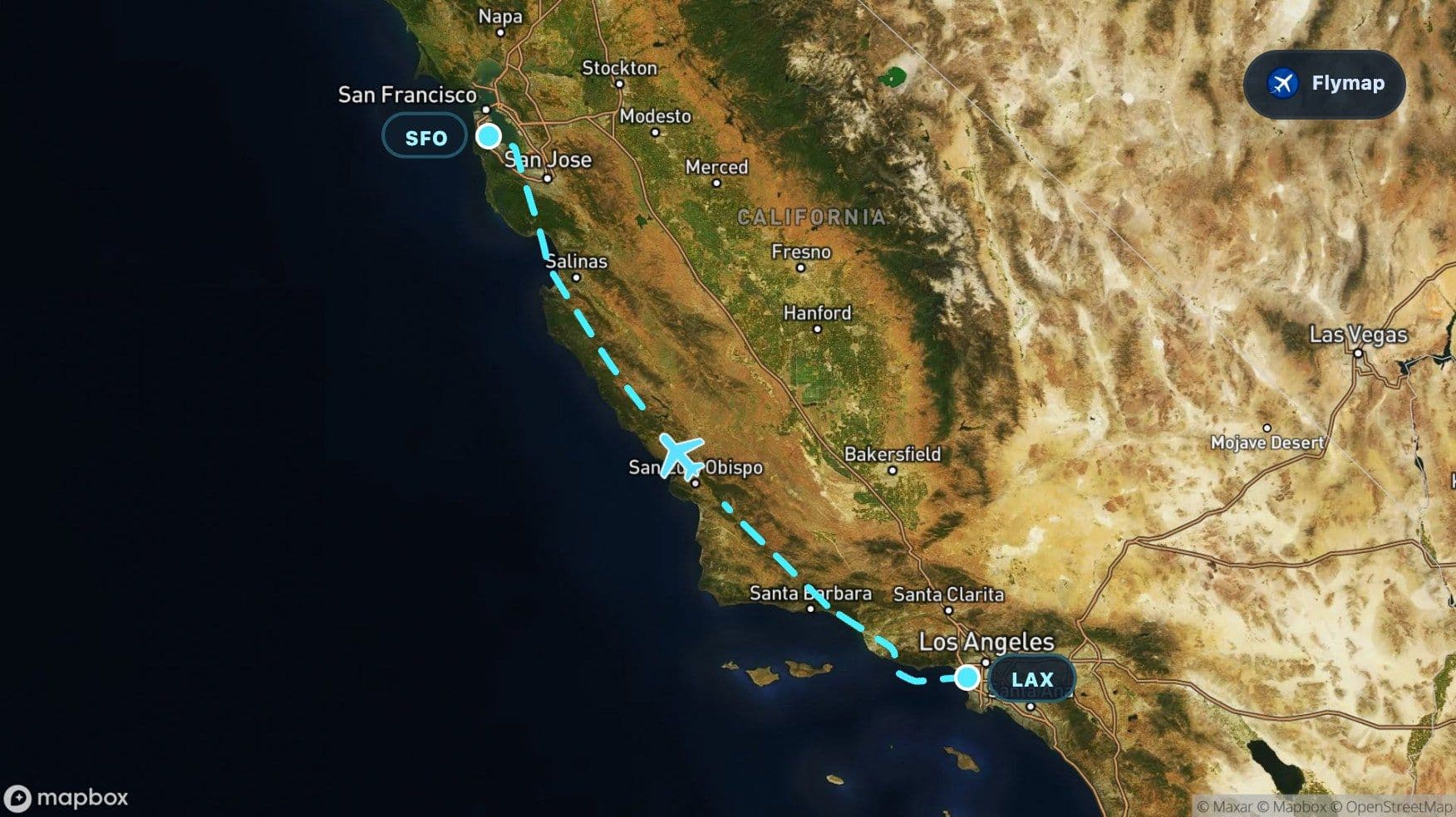
Los Angeles to San Francisco Over the Coast Ranges
See what you may fly over from Los Angeles to San Francisco, including California, Pacific Ocean, Pacific Coast Ranges and Monterey Bay.
Distance
581 km
Timing
55 min
Countries
1 country
The most memorable part of this short California flight is not simply the jump from one big city to another. It is the long run over the Pacific Coast Ranges: a coastal mountain system that sits between the ocean and the inland valleys, giving the route a rugged, textured spine before the aircraft reaches the Bay Area.
On Flymap, this route becomes easier to read because the scenery changes quickly. In under an hour, the view can move from Los Angeles and the Pacific edge to coastal mountains, Monterey Bay, Silicon Valley, and the complex water-and-city geography around San Francisco.
A quick brush with the Pacific
Leaving Los Angeles International Airport, the aircraft starts beside one of the most recognizable urban-coastal landscapes in the United States. The Los Angeles basin spreads inland, while the Pacific Ocean sits immediately to the west.
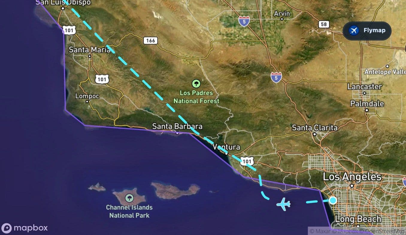
The route includes a short early section over or near the Pacific Ocean. From a window seat, this can mean a quick glimpse of open water, beach cities, or the coastal edge around Los Angeles before the aircraft settles into the northbound journey.
Nearby places in the wider departure landscape include Santa Monica, Long Beach, Malibu, the Santa Monica Mountains, and Santa Catalina Island. Visibility depends on the departure path, window side, and cloud cover, but the contrast is clear: city grid on one side, ocean on the other.
The Coast Ranges become the main story
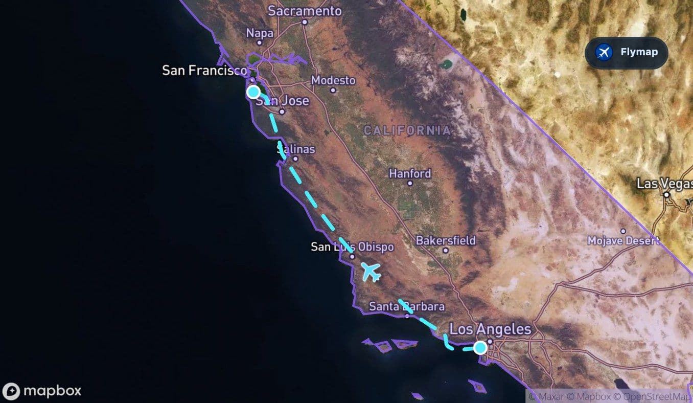
The Pacific Coast Ranges are the dominant landform on this route. They do not appear as one single wall of mountains. Instead, they create a long, irregular belt of ridges, hills, valleys, and coastal uplands running through much of the flight.
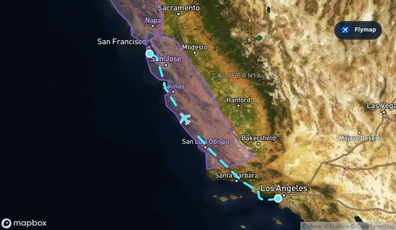
From above, this part of California can look folded and uneven. Roads and towns often sit in valleys or flatter pockets, while the higher ground appears as darker ridges and rougher terrain. The aircraft is not crossing the Sierra Nevada; it is following the coastal mountain system that separates the ocean-facing side of California from the interior.
This is the best part of the flight for watching texture rather than individual landmarks. The mountains create the rhythm: ridge, valley, ridge, coast, and then another stretch of upland.
Central Coast clues from the window
As the route continues north, the wider Central Coast region adds more detail. The places associated with this corridor include Santa Barbara, Santa Maria, San Luis Obispo, Morro Bay, and the Santa Cruz Mountains. Some may be offset from the exact line of sight, but they help explain the type of landscape below: coastal cities, agricultural valleys, rugged hills, and ocean-facing terrain.
A passenger might notice a few repeating patterns:
- mountains and hills close to the shoreline
- valleys that look greener or more cultivated than the surrounding uplands
- a less continuous urban grid than Los Angeles or the Bay Area
- coastal curves appearing and disappearing as the route moves north
This is where the flight feels especially Californian: mountains, ocean, towns, and farmland arranged in a narrow coastal corridor.
Monterey Bay: the curved pause before the Bay Area
Monterey Bay is a brief section of the route, but it is one of the clearest visual anchors. After the long texture of the Coast Ranges, the bay opens as a broad curve of water along the California coast.
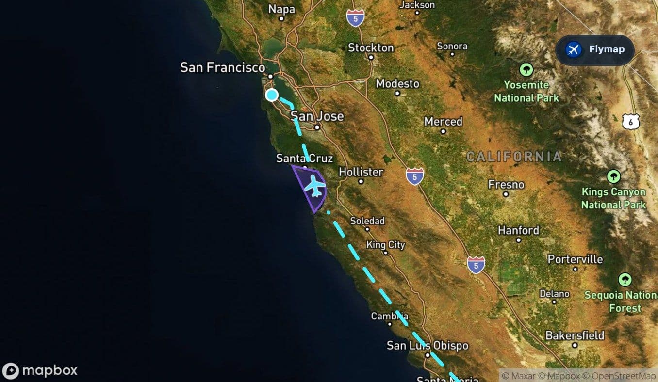
Monterey, Pacific Grove, Capitola, Watsonville, and the Santa Cruz area belong to this wider coastal landscape. From above, the bay can appear as a smooth break in the rugged pattern: open water, coastline, and nearby lowlands framed by hills.
On this flight, Monterey Bay is not long in time, but it can be big in the window.
From coastal mountains to Silicon Valley
North of Monterey Bay, the route approaches the Bay Area side of California. The Santa Cruz Mountains and the southern Bay Area begin to shape the view, with San Jose and Silicon Valley towns such as Cupertino, Mountain View, Sunnyvale, Palo Alto, and Menlo Park in the wider region.
The visual mood changes again. Instead of the looser pattern of the Central Coast, the ground becomes more built-up and organized. Urban areas, roads, business parks, airports, and bay-edge wetlands can all appear as the aircraft descends toward San Francisco International Airport.
This is also where the route’s geography becomes more layered. The aircraft is no longer simply following mountains and coast; it is entering a region defined by water, hills, cities, and technology corridors packed close together.
San Francisco Bay at the finish
The final approach into SFO is shaped by San Francisco Bay. Even when the city itself is not directly below the aircraft, the bay creates a strong sense of arrival: water, shorelines, bridges, islands, and dense urban edges.
Places in the wider arrival landscape include San Francisco, Oakland, San Jose, San Francisco Bay, Alcatraz Island, Angel Island, Yerba Buena Island, and Treasure Island. Depending on the approach path, a passenger may see some of these clearly, or only read the region through its larger shapes: bay water, peninsula, hills, and airport runways near the shoreline.
After the Coast Ranges, the arrival feels like a compressed geography lesson: mountains behind, bay ahead, city around, and the aircraft touching down beside the water.
Route summary
- The route runs from Los Angeles International Airport to San Francisco International Airport entirely within California.
- The Pacific Coast Ranges are the main geographic feature, shaping much of the flight north.
- The Pacific Ocean appears early, close to the Los Angeles departure side.
- Monterey Bay provides a distinctive curved coastal landmark before the Bay Area.
- The final approach is defined by San Francisco Bay, peninsula terrain, and dense Bay Area development.
*Data based on a historical route track for WN2433.
Route Gallery (4 images)
Download this or any other flight map in Flymap app
Open Flymap on your phone for app-store download links and offline-ready flight maps.
Flymap app