June 11, 2026
Luton to Bucharest: The Carpathian Wall Before Otopeni
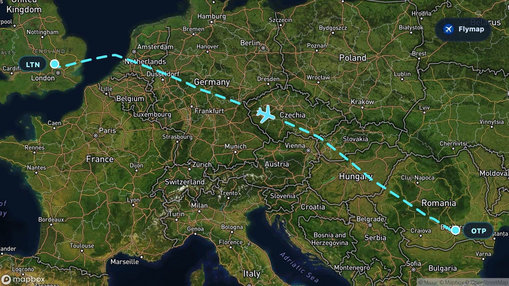
See what you may fly over from Luton Bedfordshire to Otopeni, including United Kingdom, British Isles, Great Britain, North Sea and Netherlands.
Distance
2,167 km
Timing
2h 35m
Countries
7 countries
This route saves its strongest visual moment for late in the flight. After leaving the soft, low landscapes of southern England, it crosses sea, delta country, northern plains, central European uplands and the flat Hungarian basin — then the land suddenly gathers into the Carpathian Mountains before the descent toward Otopeni.
The destination starts with mountains
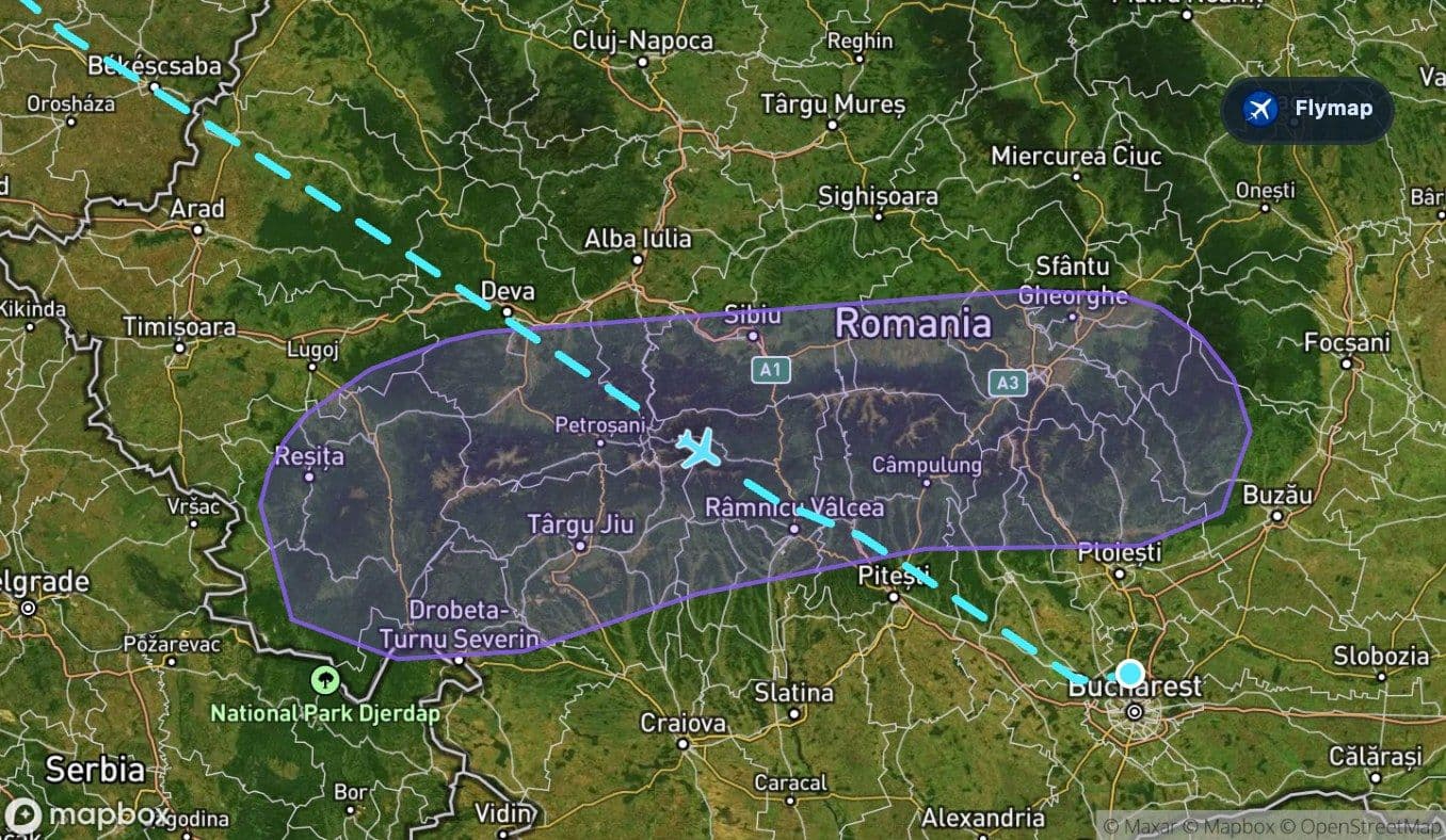
For much of the journey, the view is broad rather than dramatic: coastlines, fields, rivers and low hills. The reveal comes after the aircraft reaches Romania. The Carpathians form a long mountain arc across eastern Europe, and this route meets that arc before continuing toward the Bucharest area.
The Southern Carpathians are especially important here. From a window seat, cloud cover permitting, they can appear as a sharper, darker, more textured landscape after the flatter ground of Hungary. Instead of a single peak, expect a chain: forested slopes, valleys, ridges and higher ground running across the horizon.
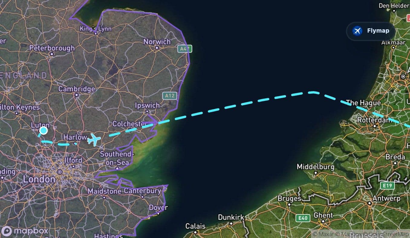
First, England falls away quickly
The flight begins at Luton Bedfordshire, north of London, and spends only a short early portion over Great Britain. This is the fast transition phase: towns, roads and fields below, then the land opens toward the eastern side of England.
Because the early route also sits within the broader British Isles and Great Britain regions, Flymap can help separate overlapping geography: the country, the island, and the wider archipelago are not the same thing, even though they stack together at the start of the journey.
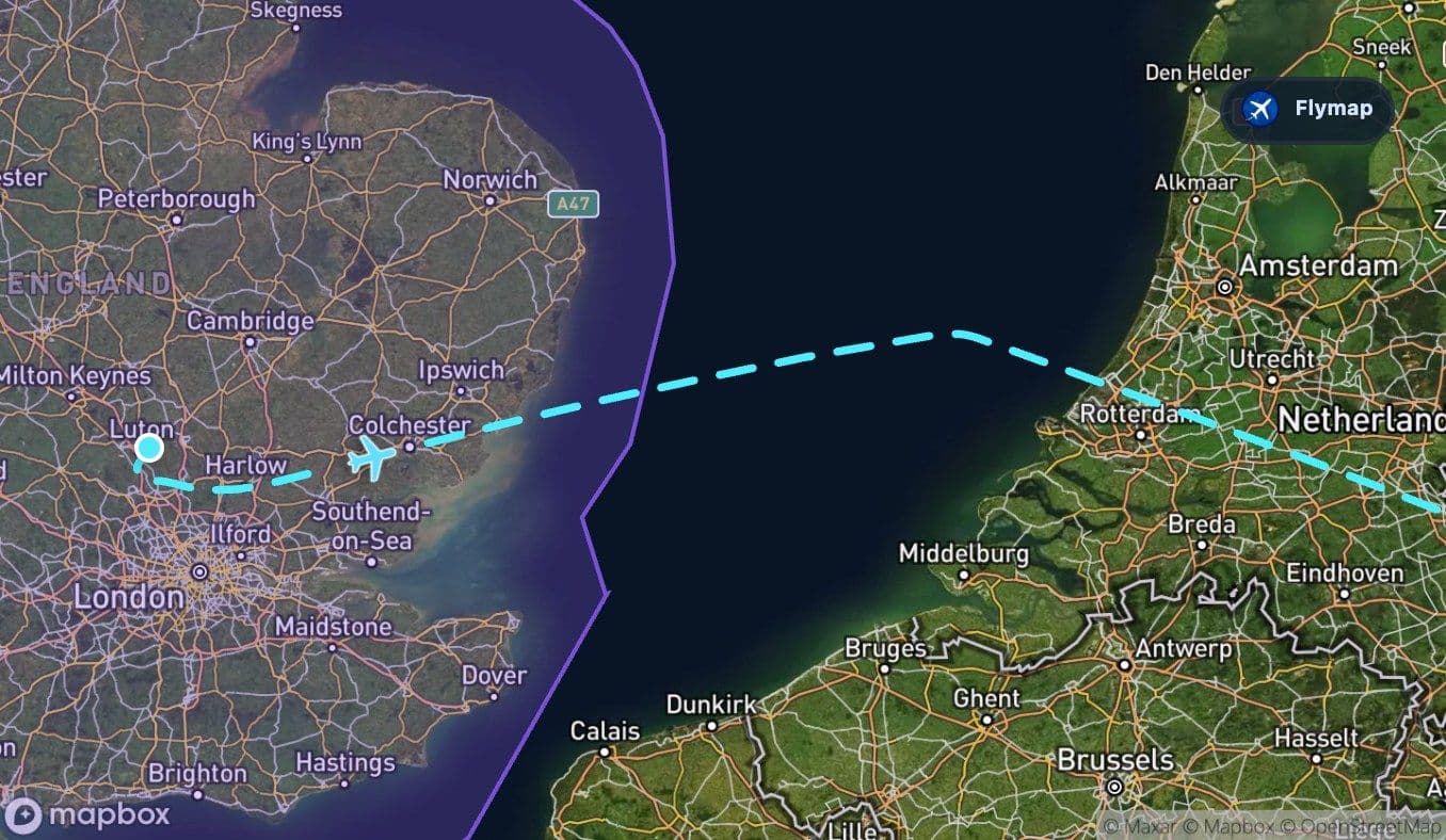
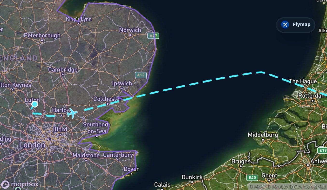
A short sea crossing resets the view
Soon after departure, the aircraft crosses the North Sea. On a clear day this can feel like the first clean break in the route: the patterned land disappears and the view becomes a wide, flat surface of water.
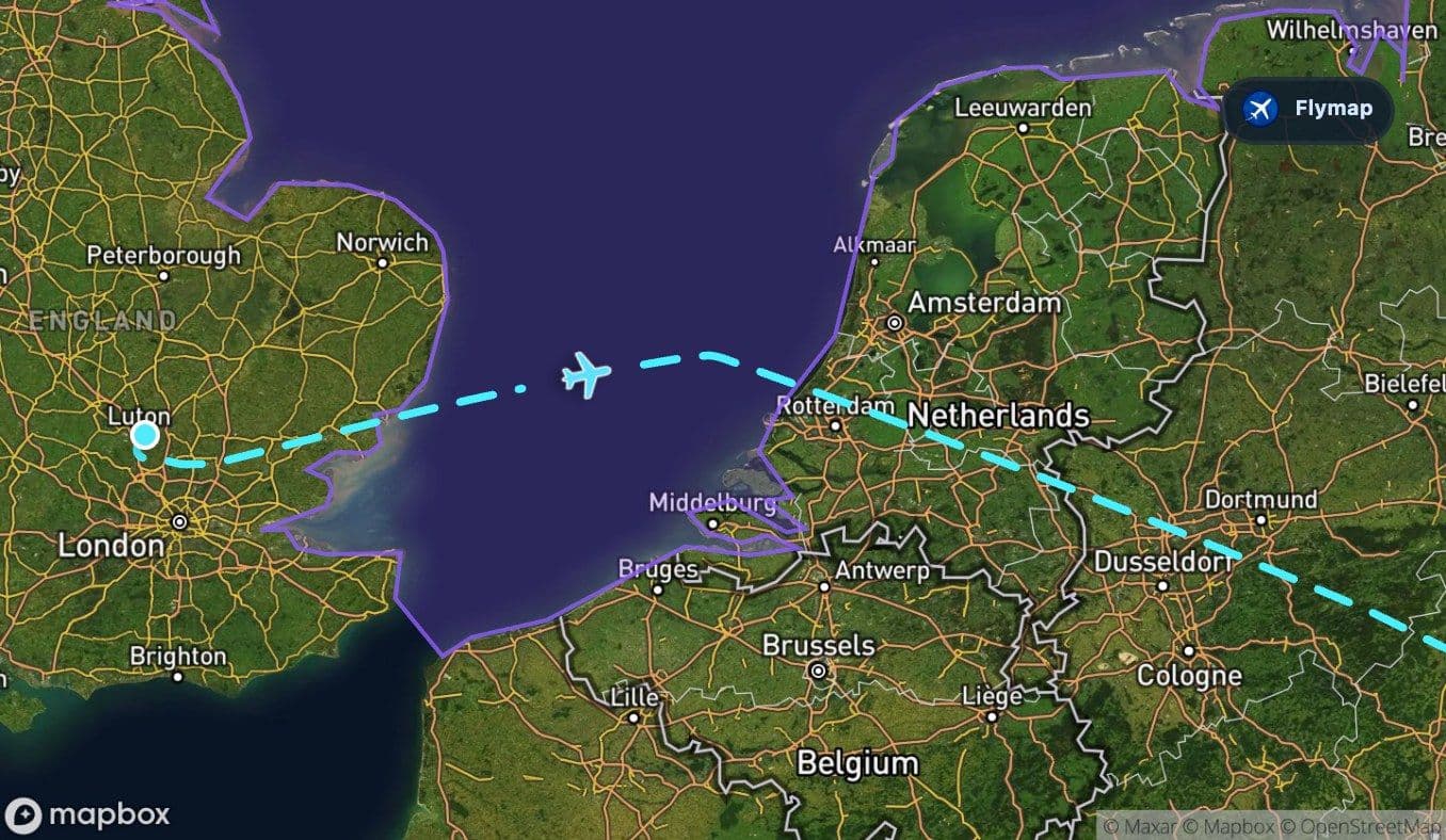
The crossing is not long compared with the whole flight, but it changes the rhythm. The route has left the British Isles behind and is now aiming for mainland Europe.
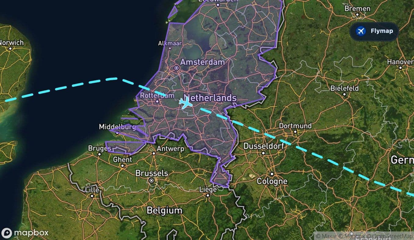
Low countries, flatlands and the broad European middle
The Netherlands appears next, followed by the North European Plain. This is a low-lying part of Europe where the landscape can look unusually ordered from above: straight lines, reclaimed-looking geometry, river channels and dense human settlement.
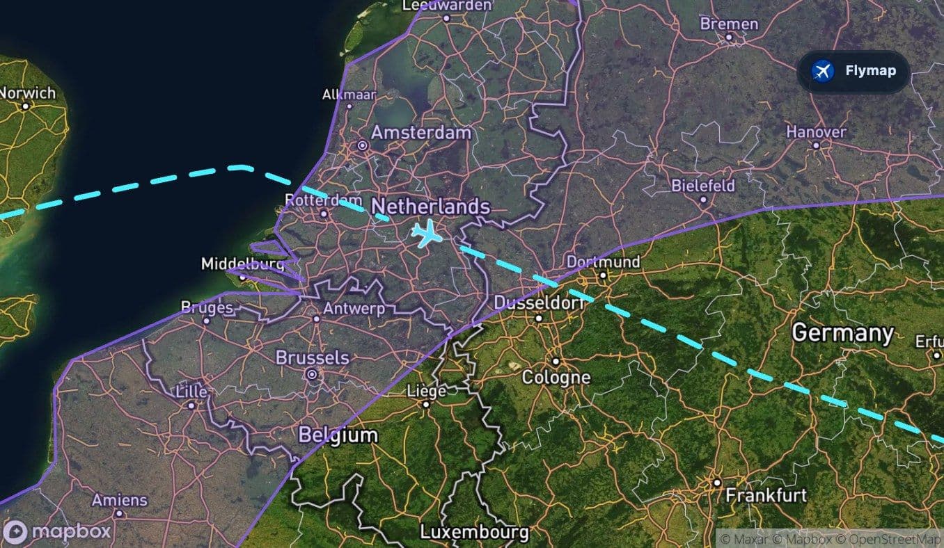
The North European Plain is a broad region rather than a precise visual object, so the best way to read it from the window is by texture. The land is generally low and open, and the aircraft then continues into Germany for a longer central section of the flight.
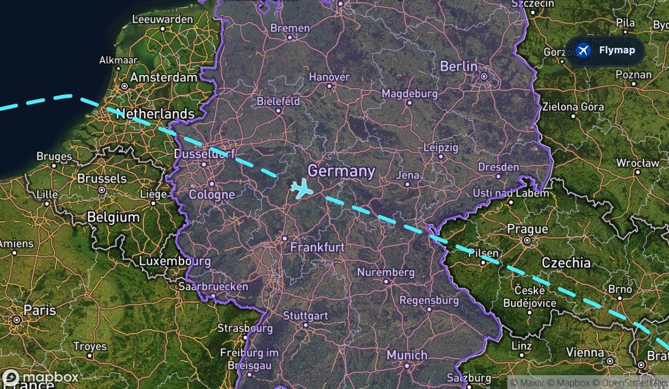
Germany to Czechia: the ground begins to rise
Germany is the longest middle-country segment on this route. The view can shift from flatter northern and western terrain into more varied uplands as the aircraft approaches the Czech–German border region.
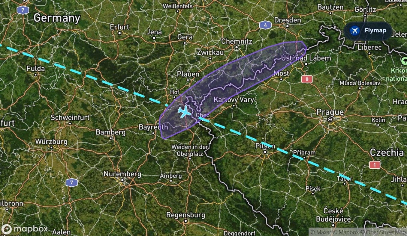
A key marker here is the Ore Mountains, a relatively brief but meaningful ridge crossing. They form a long borderland range with forested slopes and a plateau-like crest. The aircraft does not spend long over them, but they signal that the route is moving from plain country toward a more broken Central European landscape.
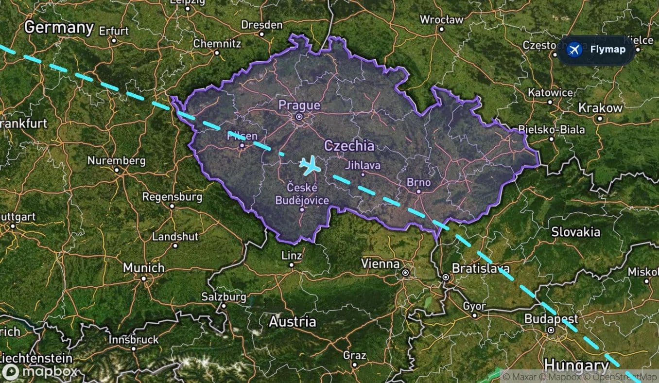
After that, the route continues across the Czech Republic, where rolling plains and low mountains replace the flatter feel of the earlier flight.
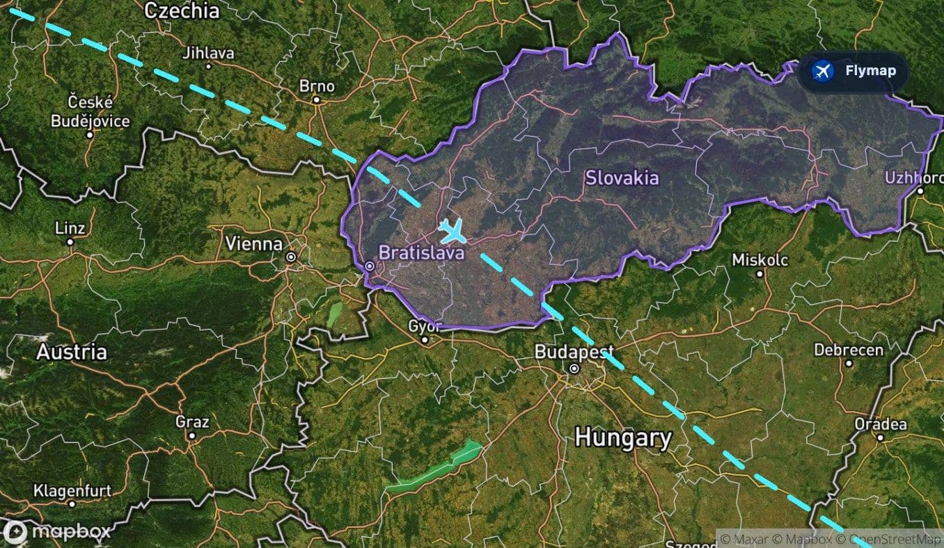
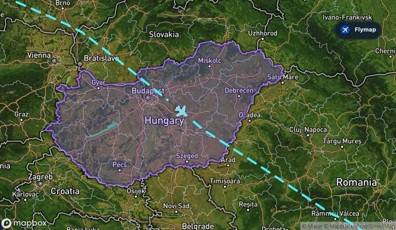
The plain before the payoff
Slovakia comes next, then Hungary. This section is important because it sets up the final contrast. Hungary lies in the Carpathian Basin, and the route crosses the Great Hungarian Plain before entering Romania.
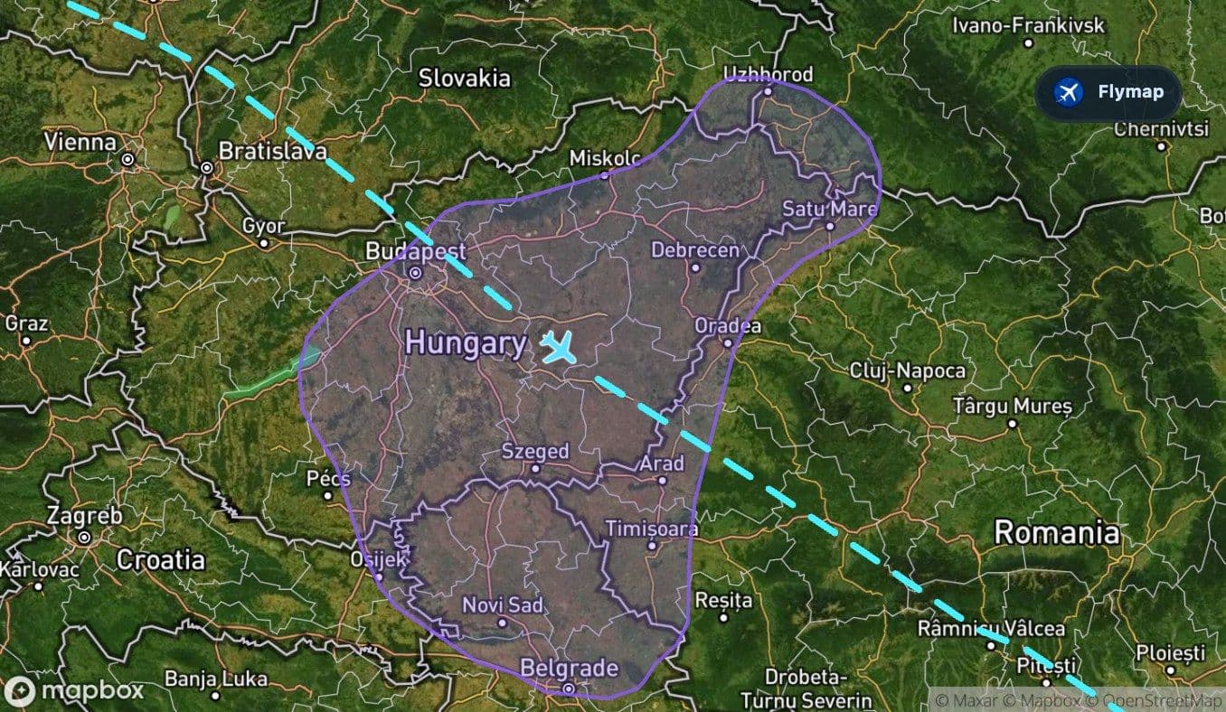
From above, this can feel like a visual pause: flatter land, river systems and broad agricultural patterns before the mountains return. It is the calm before the route’s strongest terrain shift.
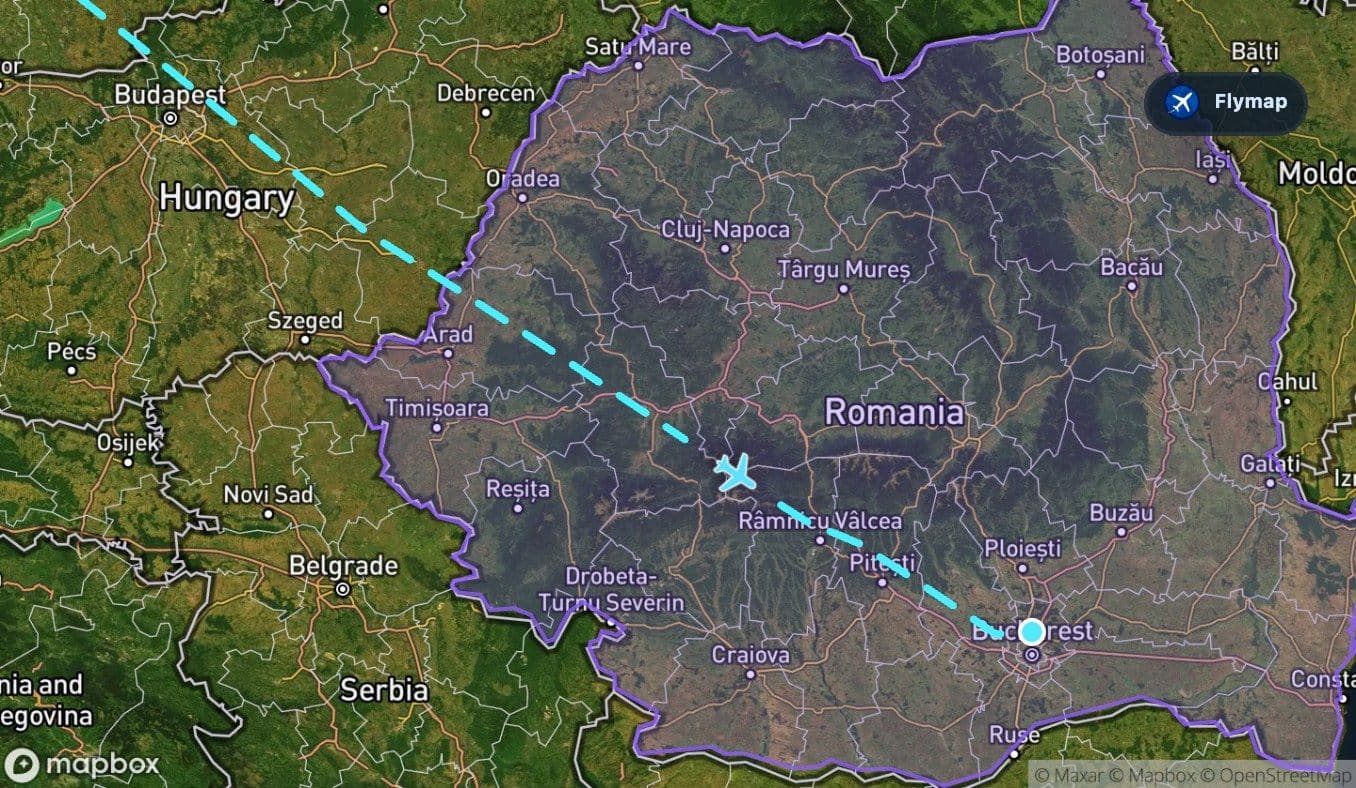
Romania: over the Carpathian arc toward Otopeni
Once the aircraft reaches Romania, the geography becomes more distinctive again. The Carpathian Mountains form the final major natural feature on the route, followed by the approach toward the lower ground around Bucharest and Otopeni.
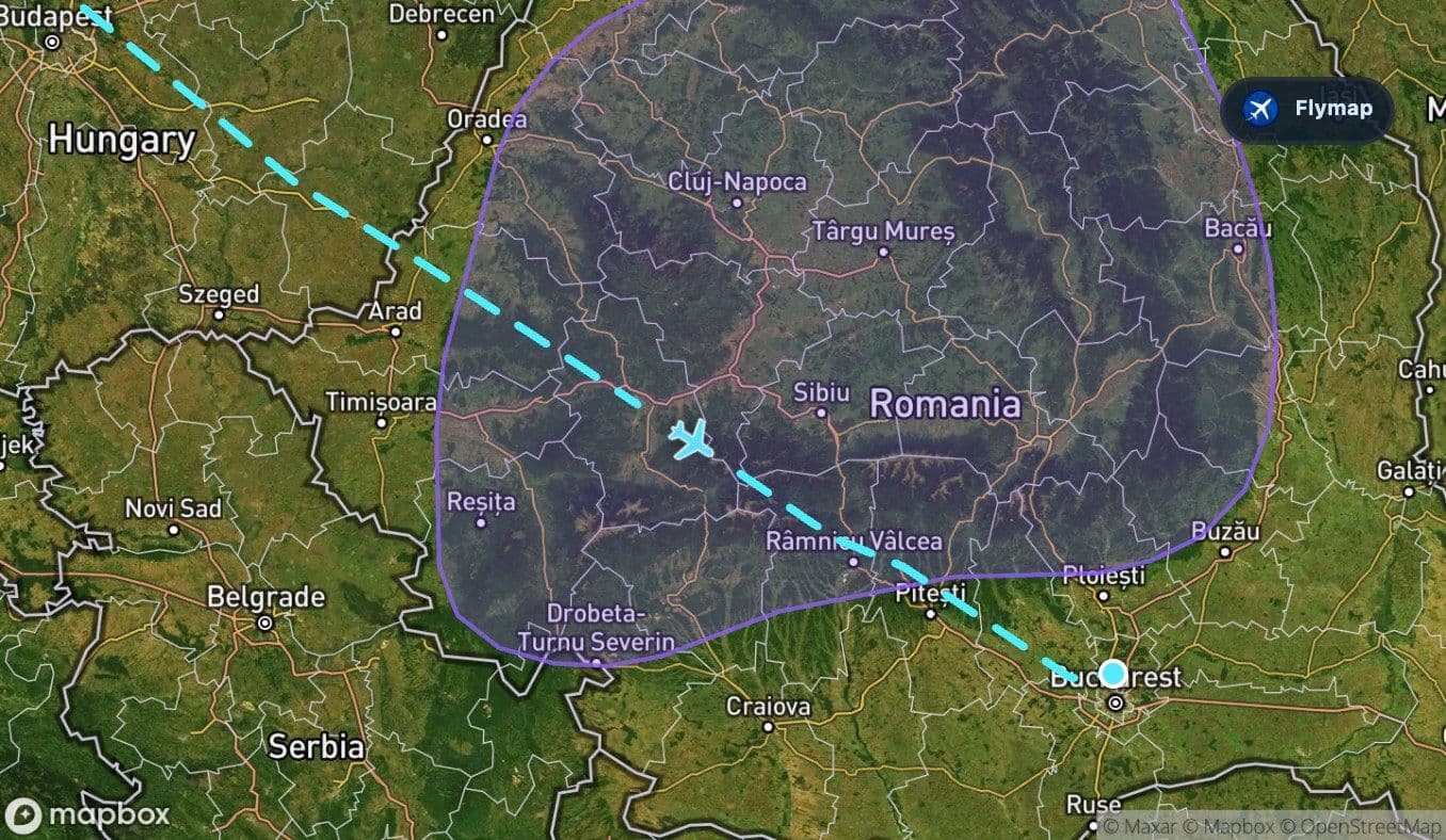
This is where watching the map alongside the window view becomes especially rewarding. Flymap can show when the aircraft is over Romania, when the Carpathian arc begins, and how the Southern Carpathians fit inside the wider mountain system.
The arrival side is not just another country crossing. It is the route’s reveal: plains giving way to mountains, then mountains giving way to the lower landscapes around the Romanian capital.
Route summary
- Starts at Luton Bedfordshire and leaves Great Britain early in the flight.
- Crosses the North Sea before reaching the Netherlands and the North European Plain.
- Spends a long middle section over Germany and the Czech Republic, with the Ore Mountains as a brief ridge crossing.
- Passes over Slovakia, Hungary and the Great Hungarian Plain before entering Romania.
- Builds toward the Carpathian Mountains and Southern Carpathians before arrival at Otopeni.
*Data based on a historical route track for W43004.
Route Gallery (15 images)
Download this or any other flight map in Flymap app
Open Flymap on your phone for app-store download links and offline-ready flight maps.
Flymap app