June 13, 2026
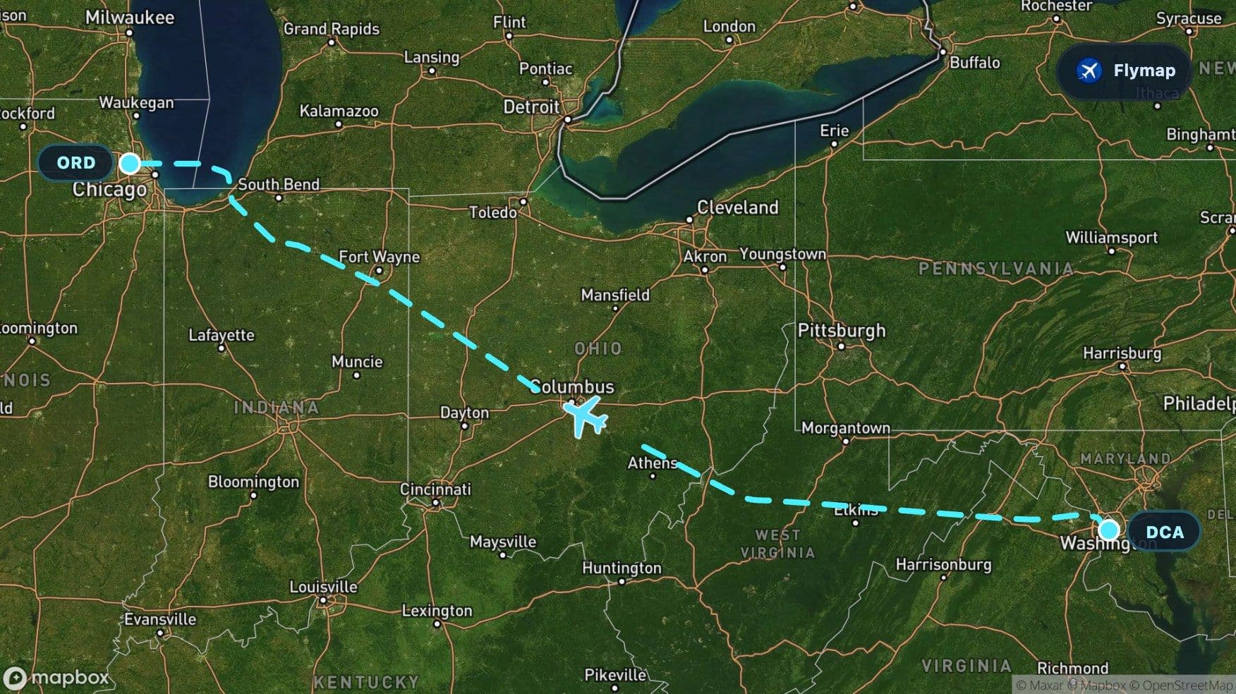
Washington to Chicago Over the Appalachians
See what you may fly over from Ronald Reagan Washington National to Chicago O'Hare, including Virginia, Appalachian Mountains, Blue Ridge Mountains, West Virginia and Allegheny Plateau.
Distance
1,041 km
Timing
1h 35m
Countries
1 country
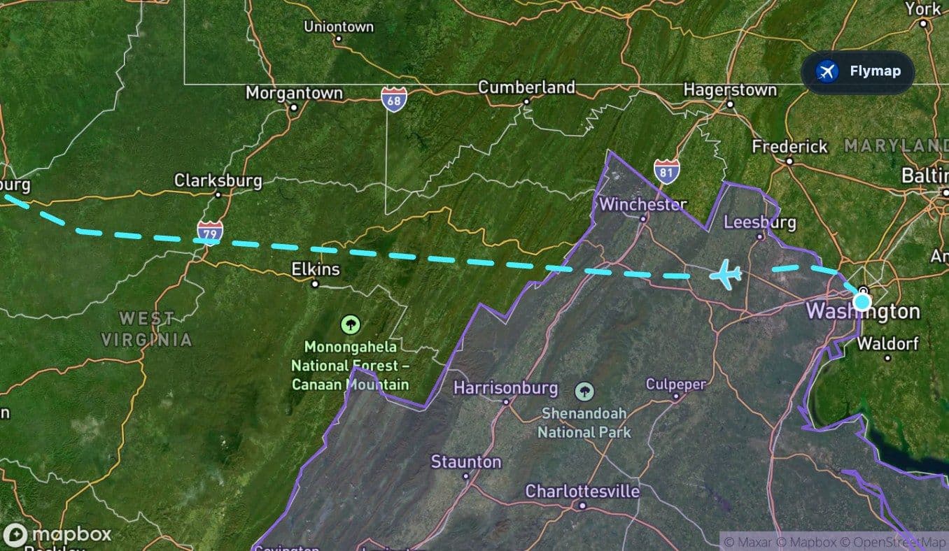
Soon after leaving Washington, the flight begins to trade city blocks and river bends for the long, rumpled texture of the Appalachian Mountains. This is the visual heart of the route: a quick climb from the Potomac corridor into ancient ridges, forested valleys, and uplands before the landscape relaxes into the flatter Midwest.
Flymap is especially useful on this kind of flight because the route changes character several times in a short journey. What may look like an ordinary inland hop is really a compact cross-section of eastern North America.
The ridges arrive quickly
From Washington National, the first views are often shaped by the Potomac River and the urban edge of Washington. Depending on the side of the aircraft and cloud cover, the National Mall area, the Tidal Basin, or the broad Potomac corridor may help orient the departure.
But the route does not stay urban for long. The aircraft heads toward Virginia’s rolling landscape, where the ground begins to rise and fold. The Appalachian Mountains appear early, not as sharp alpine peaks, but as long, worn ridges and valleys.
From above, the Appalachians can look like waves fixed in place: parallel lines of forest and shadow, softened by age and erosion. They are not dramatic in height compared with younger mountain ranges, but their pattern is striking from a window seat.
Blue Ridge: the first clear mountain signature
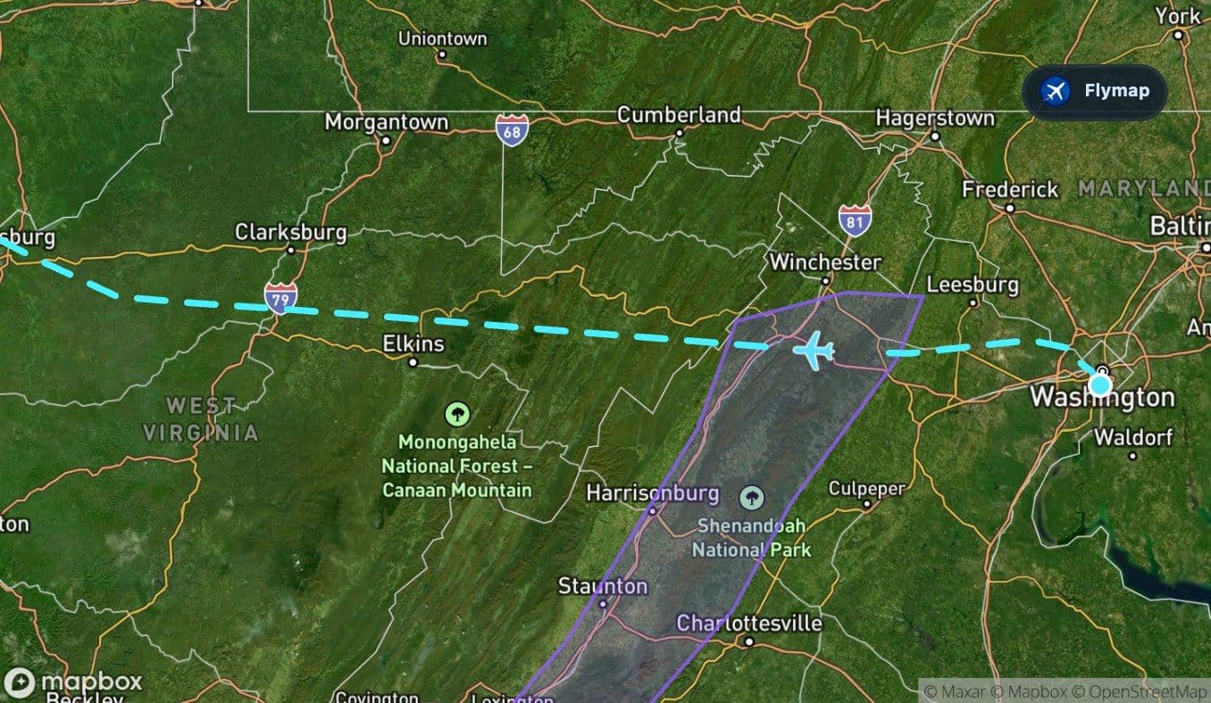
The Blue Ridge Mountains form one of the first clearly recognizable highland sections. On a clear day, this part of the route may show the classic ridge-and-valley texture of the eastern United States: green slopes, rounded summits, and long natural corridors between them.
This is a good moment to look for contrast rather than individual landmarks. The aircraft is moving from the coastal and river-influenced landscape around Washington into a much older mountain system. Roads, towns, and rivers often follow the valleys, while the ridgelines create darker bands across the view.
A passenger may notice:
- long forested ridges running in repeated lines
- valleys that look smoother and more settled than the slopes
- rivers cutting through the terrain rather than simply following straight paths
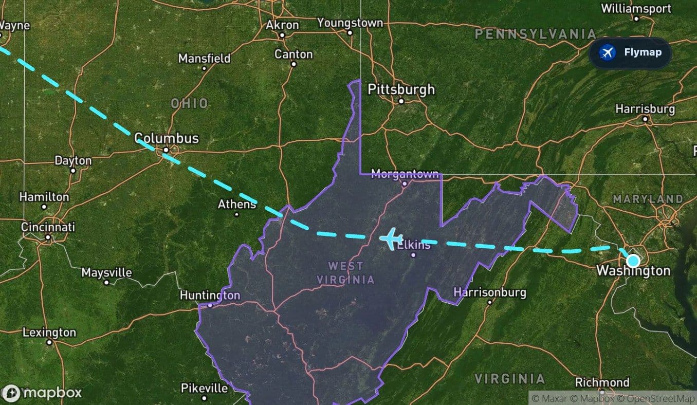
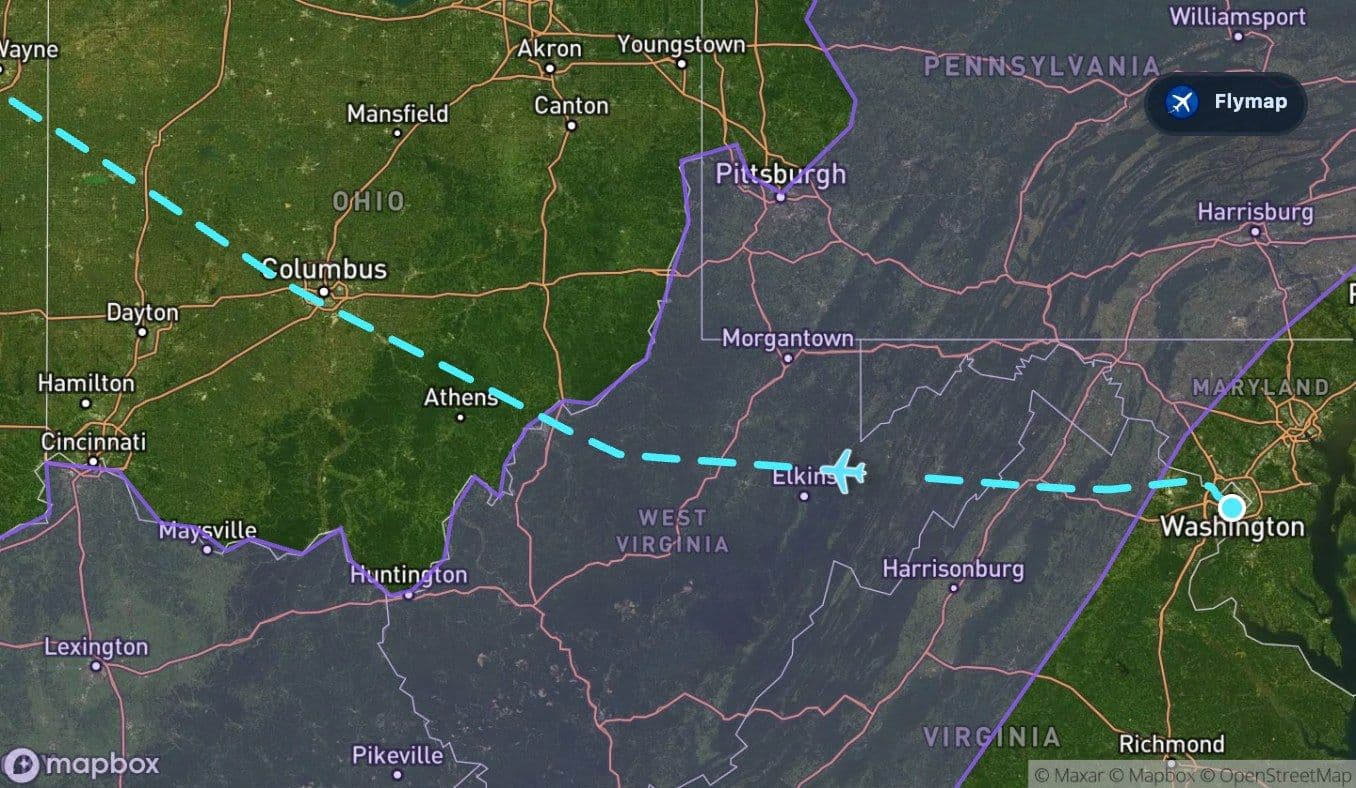
West Virginia and the highland middle
After the Blue Ridge, the route continues across West Virginia. This section keeps the Appalachian feel, but the view becomes more rugged and enclosed. The landscape below is shaped by mountains, valleys, and winding rivers rather than the square field patterns that appear later in the flight.
Spruce Knob, the highest point in West Virginia, is among the notable highland features in the wider region. The route data also includes the Allegheny Plateau, which helps explain why the terrain can look less like isolated peaks and more like an elevated, dissected surface.
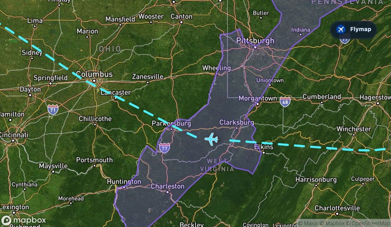
The Allegheny Plateau is broad rather than spiky. From cruising altitude, that can make the ground look like a raised landscape carved by water: uplands, river valleys, and wooded folds continuing toward Ohio.
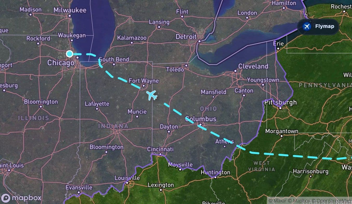
The mountains give way to Ohio
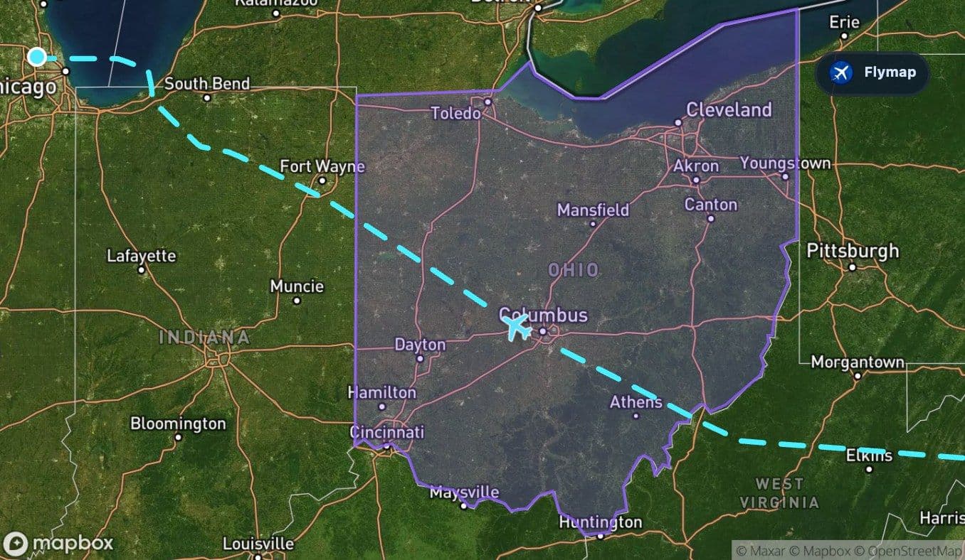
Around the middle of the journey, the visual story changes. The aircraft leaves the stronger Appalachian texture and enters Ohio, where the terrain becomes a mix of hills, plains, rivers, and larger settled areas.
Columbus lies within the wider set of places associated with this route, and Ohio’s river systems become part of the view. The Scioto and Muskingum rivers are examples of waterways that help organize the landscape below, even when they are not obvious to every passenger.
This is where the flight begins to feel more Midwestern. The view gradually becomes broader and more open, with fewer long ridges and more regular patterns of fields, roads, and towns.
The long plain toward Indiana
The Central Lowlands dominate the second half of the route. This is a broad plain region, and the change from the Appalachians is easy to understand from above: the landscape looks flatter, wider, and more geometric.
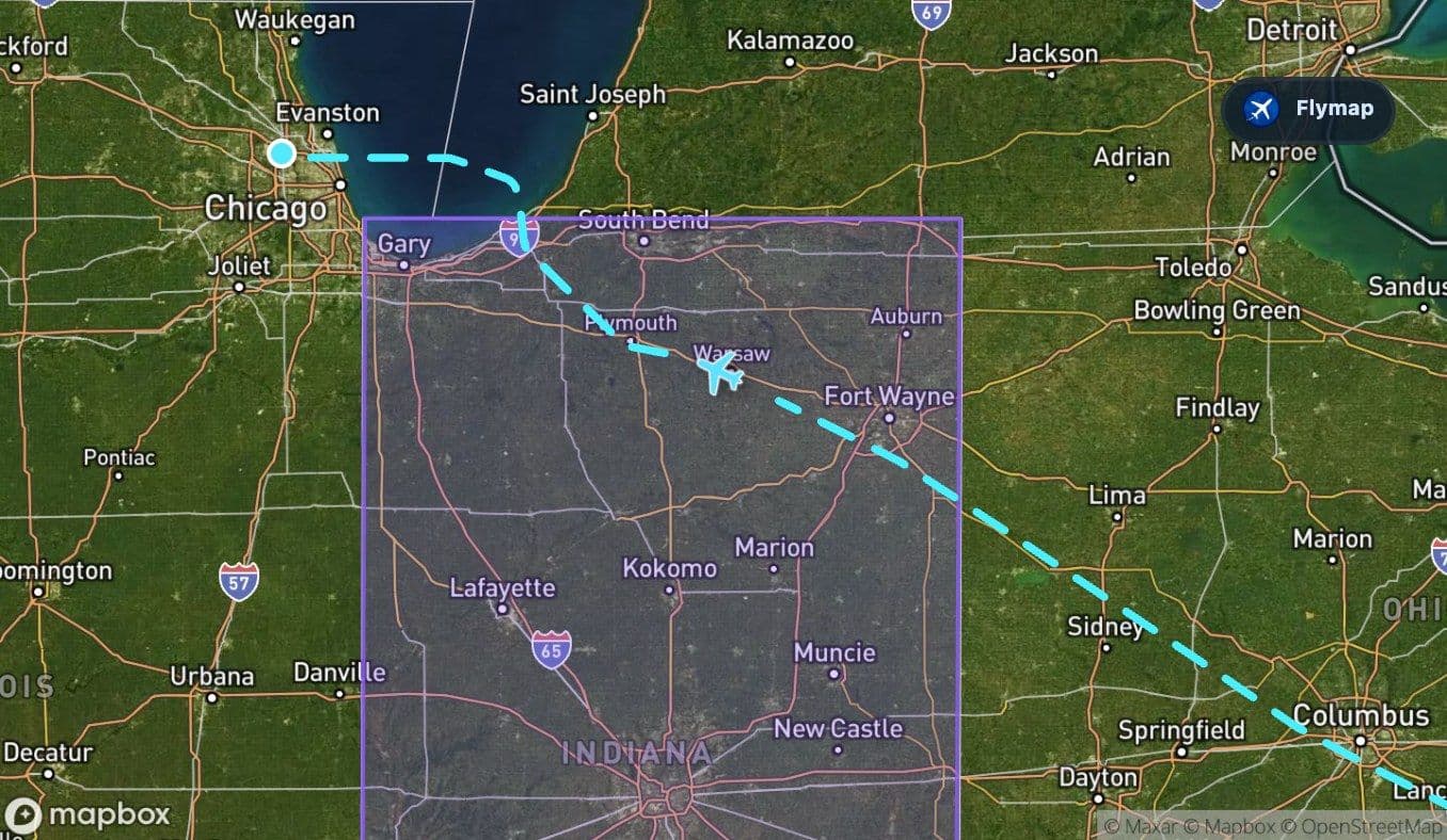
Across Ohio and Indiana, the route passes over a mostly flat to gently rolling landscape. Rivers remain important, but the terrain no longer feels mountain-led. Instead, the view is often a patchwork: fields, towns, roads, and drainage lines spreading toward the Great Lakes system.
Indiana continues that pattern. Places such as Fort Wayne and South Bend sit within the wider corridor of this route, and the St. Joseph River and Wabash River belong to the regional water network that gives the flat landscape its shape.
The biggest visual shift on this flight is not city to city. It is ridges to lowlands.
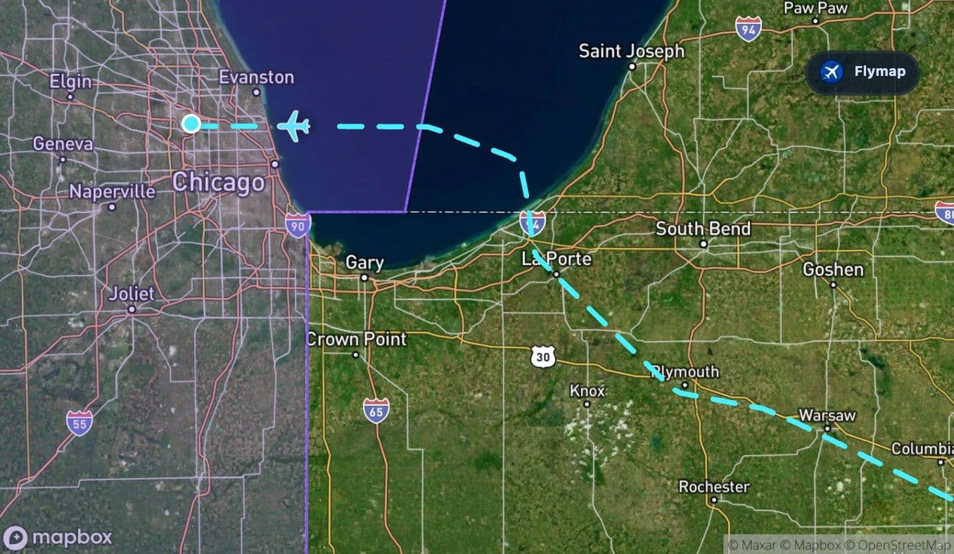
Lake Michigan appears near the finish
Near the end of the flight, the route brushes the Great Lakes world. The track includes a short stretch associated with Michigan state and then Lake Michigan itself, one of the route’s clearest late-flight visual markers.
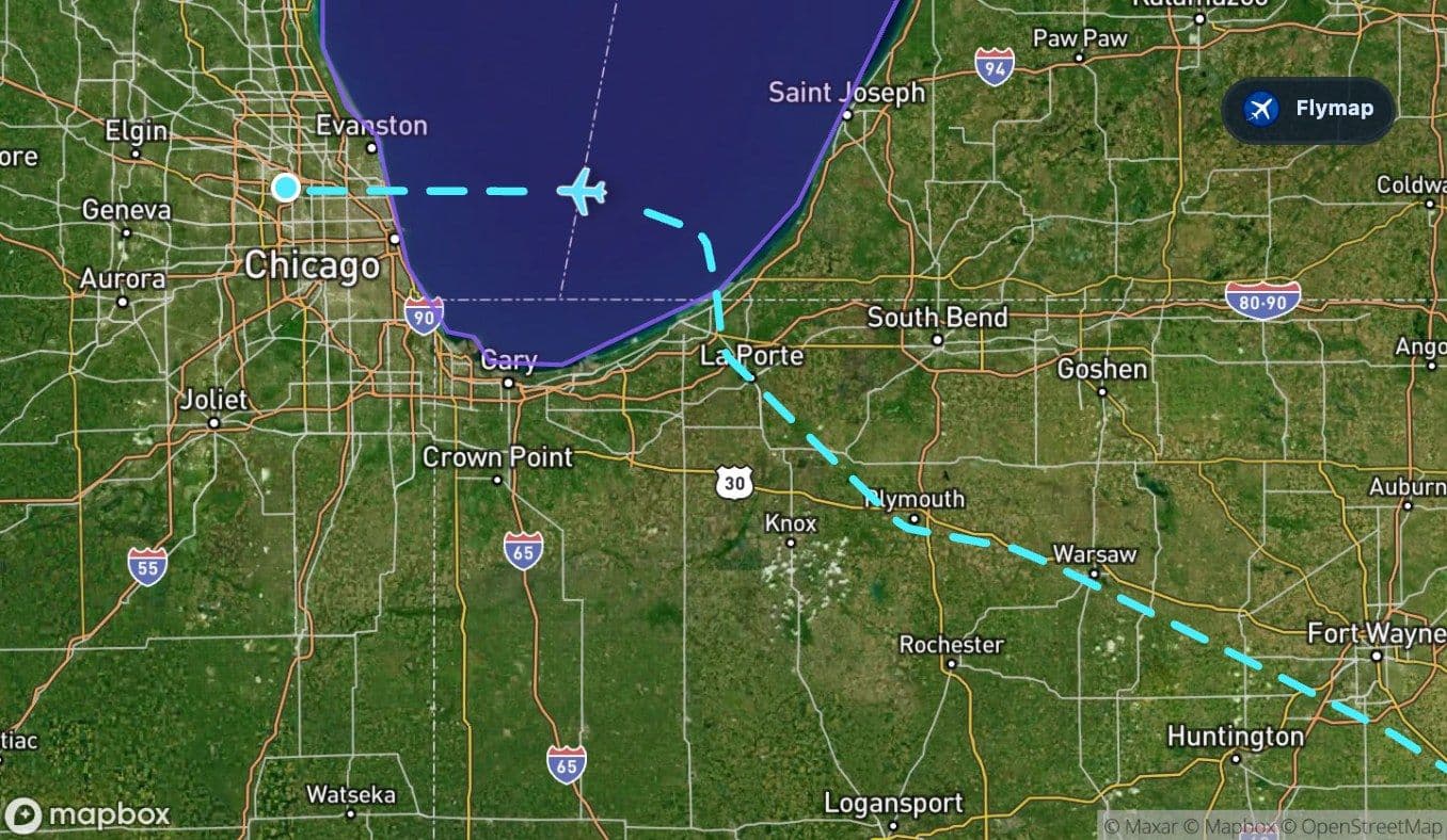
Lake Michigan can feel surprisingly large from the air. Even a brief crossing or shoreline view changes the mood of the approach: after plains and fields, a broad freshwater horizon appears, bordered by urban and industrial landscapes around the southern end of the lake.
Chicago’s setting is defined by this lake edge. As the aircraft approaches O’Hare, the city region may appear as a dense grid, with the lake, rivers, suburbs, rail lines, and airport infrastructure all competing for attention below.
Arrival over the Chicago region
The final minutes bring the route into Illinois and the Chicago metropolitan area. The landscape is flatter than the Appalachian start, but visually busy: urban blocks, transport corridors, industrial areas, suburbs, and airport runways.
O’Hare’s runway system is one of the easiest features to understand from above because it creates a huge geometric pattern on the northwest side of Chicago. After crossing mountains, plateau, plains, and lake-influenced terrain, the flight ends in one of the most built-up aviation landscapes in the United States.
Route summary
- The route runs from Washington National to Chicago O’Hare entirely within the United States.
- The standout feature is the early crossing of the Appalachian Mountains, including the Blue Ridge and West Virginia highlands.
- The Allegheny Plateau creates a broad upland transition before the landscape opens into Ohio.
- The second half of the flight is dominated by the Central Lowlands across Ohio, Indiana, and Illinois.
- Lake Michigan adds a final geographic highlight before the approach into the Chicago area.
*Data based on a historical route track for AA1200.
Route Gallery (11 images)
Download this or any other flight map in Flymap app
Open Flymap on your phone for app-store download links and offline-ready flight maps.
Flymap app