Flymap guide
Offline flight maps: see your whole route without internet
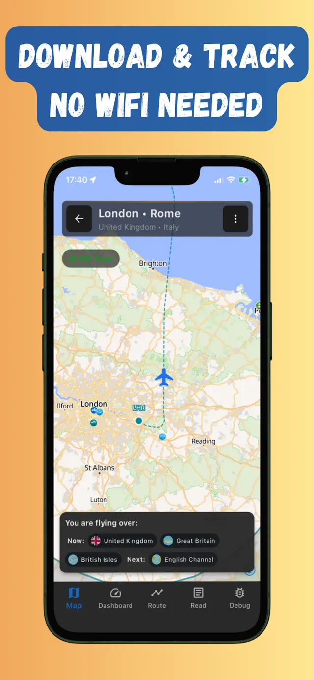
An offline flight map is a map of your flight route saved to your phone before takeoff, so it keeps working when there is no Wi-Fi, no mobile data and no roaming — which describes most of every flight. Pair it with your phone’s GPS (which works fine in Airplane mode) and you can follow your plane across the map for the entire journey.
Why download a map before you fly
- There’s usually no usable internet up there. Many aircraft have no Wi-Fi at all, and paid onboard Wi-Fi is often slow, capped or blocked for map apps.
- Regular map apps go blank. Google Maps and Apple Maps stream tiles from the internet, so mid-flight you mostly get a grey grid. (More in Can you use Google Maps on a plane?)
- Seatback maps are hit-and-miss. Budget airlines don’t have them, and when they exist they’re low-detail and stuck at one zoom level.
- The world below is the best in-flight entertainment. Alps, glaciers, coastlines, cities at night — if you know where to look and what you’re looking at.
What a good offline flight map includes
Downloading “a map” isn’t enough — a screenshot of your route would technically be a map. To be useful at 11 000 metres, an offline flight map should include:
- The whole flight corridor — not just cities at each end, but a band of detailed map either side of the route, because planes rarely fly the exact straight line.
- Terrain and nature — mountains, lakes, rivers, islands and coastlines are what you actually see from a window seat.
- Points of interest with context — names and short descriptions of the places you pass, so “big lake” becomes Lake Geneva.
- Your live GPS position — the map is far more fun when your plane is moving across it.
How to download your flight map in Flymap
- Get the app — download Flymap for iPhone or Android while you still have internet.
- Search your route — enter your departure and arrival airports (for example LHR → FCO). Flymap builds the flight corridor and shows everything you may fly over.
- Download the corridor — one tap saves the map, points of interest and optional offline Wikipedia bundles for the route.
- Board and switch to Airplane mode — your GPS position, speed and altitude keep updating on the downloaded map from take-off to landing.
Offline areas in Google Maps vs a flight-specific map
You can save offline areas in general-purpose map apps, but they’re designed for driving around a city, not crossing a continent: you’d need to stitch together many rectangles to cover a long-haul route, the downloads are heavy, and there’s no concept of a route timeline, no “what am I flying over right now”, and no flight dashboard. A flight-first app downloads exactly the corridor you need and layers the flight experience on top.
Frequently asked questions
How much storage does an offline flight map take?
A typical route corridor in Flymap is a few hundred megabytes — much smaller than downloading whole countries in a general map app, because it only covers the band of land along your route.
When should I download the map?
Any time before boarding while you have internet — at home the night before is ideal. Airport Wi-Fi works too; the download usually takes a few minutes.
Do downloaded maps expire?
No. Once a route is on your device it stays available offline, so you can also revisit past flights or prepare return legs in advance.
Does it work on any airline?
Yes. The map and GPS tracking live entirely on your phone, so it works the same on any airline, aircraft or route — no onboard Wi-Fi required.
Try it on your next flight
Get Flymap free on iPhone or Android, download your route before boarding, and see what you fly over — no Wi-Fi needed.


Flymap app
Keep reading
Can you use Google Maps on a plane?
What actually happens when you open Google Maps mid-flight, how far offline areas get you, and the flight-first alternative.
How to track your flight without Wi-Fi
Why the famous flight-tracker apps go dark mid-flight, and the offline GPS setup that keeps working from take-off to landing.
What am I flying over? How to identify what’s below your plane
Ways to put a name to the mysterious coastline below your window — from seatback maps to GPS apps that work in Airplane mode.